Pages

Friday 20 September 2013

The field team


Four weeks of intensive fieldwork represented a great opportunity for researchers and students to examine an urban area of the colonia Aurelia Apulensis, next to the insula of the Liber Pater sanctuary, unearthed by previous archaeological excavations. 

In this year the site hosted many students from Germany, Hungary and Romania, eager to experience and learn interdisciplinary and innovative methods used during field work. Due to the enthusiastic team-work, by the end of this season the remains of two different stone-buildings were identified. The functionality of the buildings, with traces of massive destruction and demolition, could not be clarified yet, this remaining the main task for the next campaign.
 

Unearthing the remains of the aforementioned constructions required a constant effort from the team. Removing the compact and thick clay alluvium layers covering the ruins required a wide range of techniques and use of tools: from mattocking and shoveling to cleaning with the hoe, trowel and brush. The members of the team could easily accomplish the basic field work techniques and learned the proper use of tools, even if the wheelbarrows were often quite heavy for some of us.

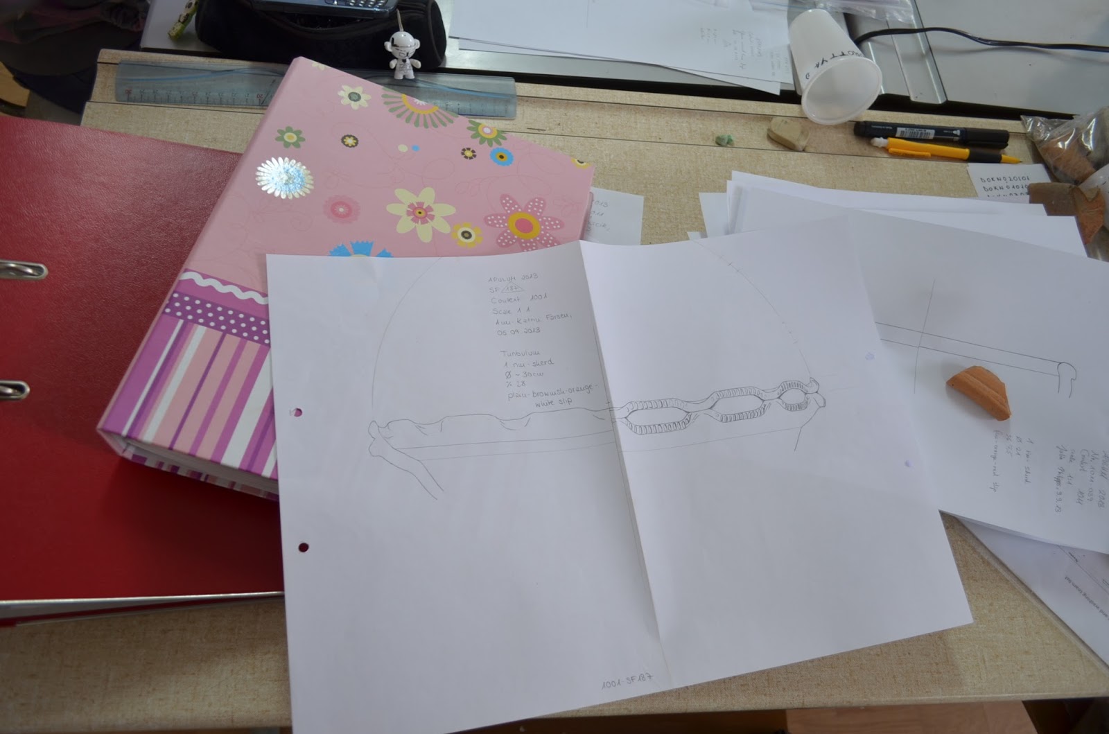
The field activity of the students was not limited to “digging” and unloading wheelbarrows. They were actively involved in the documentation process. There is no team member who did not take his share in this bustle. Everybody learned how to register and collect small-finds, how to measure them with the total station. Planning and drawing different contexts as well as completing context sheets were also among every student’s task.

Team-members were also initiated in other interdisciplinary domains like topography, archaeobotanics and GIS. They could learn on site how to use the total station, how to collect and sieve soil samples and they also took part in the topographical survey of the archaeological location. 

Beside the multidisciplinary training and hard physical work, the good atmosphere and the excellent team work have also contributed to the success of this archaeological campaign. Mission accomplished! 


Thursday 19 September 2013

Wraping up the site

 
At the end of the month the time came to backfill the site. In a cloudy and windy day a team of heroes preserved the excavated layers with plastic sheets and gazed for some hours how the JCB levels the area which was a few hours ago still THE TRENCH.


Thursday 12 September 2013

Wraping up the drawings


After a four week excavation season with a lot of physical effort, documentation work and learning/teaching experience the field team started to wrap up the work. 


The final plans and photos are being made since yesterday so everybody can test his "drawing" skills, but it is also important that all the data is as accuerate as possible. 
Apulum will be next year definitely RELOADED!


Tuesday 10 September 2013

Drawing pottery


Drawing pottery is going on - training some students with good  results. Even complicated vessels like decorated turibula can be done after one day of exercise. Some students do enjoy staying  in the lab
after weeks on site.


Why is pottery drawing so important?
Pottery is a tool to date the contexts and learn more about the function and the economical background of the site. Therefore we need the drawings of the fragments to determine the types of the vessels.
No artistic skills are needed to draw pottery: everybody can learn  it! But some students have more patience than others...

Climbing to Piatra Craivii


On Saturday, after the site tour, a small but very enthusiastic group of researchers and students climbed up to Piatra Craivii in the Trascău Mountains. This 1078 meters high peak is famous not only because of its fascinating shell-shaped white cliff but also for its historical background.


Some thousand years ago a Dacian (late Iron Age) fortification stood on the top of Piatra Craivii, and the remains of ancient life was also visible on the slopes around the peak.


Our hikers came up from the little village of Craiva and after exhausting climbing they reached the final ridge of the hill. From that point we followed the blue hiking trail sign to the top, where an iron cross represented the end of our efforts and rewarded us with a breathtaking view. 


Visiting history


On the third weekend of the project, the group had an excursion to two of the most important historical sites of the region – to the Hunedoara/Vajdahunyad Castle and to the ruins of the Roman settlement Colonia Ulpia Traiana Sarmizegetusa. The Hunedoara Castle is a late Gothic-Renaissance style castle which was mainly built in the second half of the 15th century. Its construction was started by Jancu de Hunedoara/János Hunyadi, the famous governor and the father of King Matia Corvin/Mátyás Hunyadi who was one of the most prominent rulers of medieval Hungary.


Colonia Ulpia Traiana Sarmizegetusa was perhaps the most important settlement of Roman Dacia. It was founded right after the conquest of Dacia by the orders of Emperor Traianus, as it is attested by an inscription: Auspiciis / [Imp(eratoris)] Caes(aris) divi Nervae f[il(ii)] / [Nervae] Traiani Augusti / [Germ(anici) Dac(ici)] condita colonia / [Ulpia Traiana Augusta] Dacica / [Sarmizegetusa] per / [D(ecimum) Terenti]um Scaurianum / [legatum] eius pro pr(aetore) / [------? (Translation: “By the orders of Imperator Caesar Nerva Traianus Augustus Germanicus Dacicus, son of the divine Nerva, the colony of Ulpia Traiana Augusta Dacica Sarmizegetusa was settled by Decimus Terentius Scaurianus, his governor.”) The settlement was the seat of the financial procurator of Dacia, and the concilium provinciae (a religious festivity in honour of Rome and the Emperor) was also held in the city annually.


Friday 6 September 2013

The world of pottery


Different steps of the pottery processing have been going on in the restorer’s laboratory and also in the finds processing room from the basement. The lately enormous amount of pottery (9 crates) is washed and dried in the upper lab and this is the location of the primary recording of the ceramic as well.


The pottery recording sheet contains different ware types and functional categories and helps us to have an overview about all the ceramic material. In the finds processing room students learn how to draw the typical pottery shards (rim, base, decorated body fragments, etc.) and record them in the pottery database. Many interesting fragments (turibula, paterae, miniature vessels, etc.) are already recorded in the database and some of them are carefully cleaned from the sintering crust as well. A different part of the pottery recording is the identification of ceramic fabrics and the definition of the local and imported wares, from which important information can be extracted related to the economic connections of Apulum and refers also to the consumption habits of the local population.


From the world of small finds


During the last two weeks of the excavation, a large number of various small finds have been unearthed by the archaeologists and students on the site, which are being processed in the lab. Until now, more than six hundred finds have been processed – all of them drawn, measured and recorded into our database, and some of them restored as well. Among them are silver and bronze coins, fine imported pottery, worked bone objects (e. g. hairpins, needles), glass beads, various iron and bronze objects (e. g. brooches, belt fittings) and worked stone fragments (e. g. statue fragments). All of these finds are of utmost importance, since they carry some extra information and through their analysis in the lab, they help us to improve our knowledge about the functionality, chronology and the general land use of our site and its vicinity in the Roman period.

Thursday 5 September 2013

GIS mapping team


In parallel with the excavation, a group of researchers and students, called the GIS mapping team, work in the lab. This team is dealing with all the drawn documentation and data which has geographic or topographic information.


Firstly the plans which correspond to the individual archaeological contexts of the excavation are scanned and rectified based on the grid coordinates. Every drawing is digitised and the data is stored in the form of vector layers. We use different layers depending on the type of the information, for example: contexts line, elevation data or find spots of small finds.


With the help of a geographic information system our research has an up-to-date background to analyze, display and understand different aspects of the excavation.